CCTV News:According to WeChat official account, China Meteorological Bureau, a strong cold air will affect China from January 22nd to 24th (the first day to the third day of New Year’s Day), and there will be obvious gale and cooling weather in the central and eastern regions. As a result, the temperature in the central and eastern regions will be significantly lower than normal. The Central Meteorological Observatory issued a blue warning of cold wave at 18: 00 on January 21st!

Gale cooling forecast:Affected by strong cold air, it is estimated that the temperature in most parts of central and eastern China will drop by 6-10℃ from 20: 00 on January 21 to 08: 00 on January 25.The temperature in northern North China, eastern Northeast China and eastern Jiangnan dropped by 14℃, exceeding 18℃ locally.There are 4 to 6 winds and 7 to 8 gusts in the above areas, and some areas in western Gansu, western Inner Mongolia and Ningxia have sand or floating dust. There are 6-8 winds and 9-10 gusts in most offshore areas of China. The lowest temperature in the process appears on the morning of 24th to 25th, and the lowest temperature line of 0℃ will be located in the east of Yunnan, south of Guizhou and north of South China.
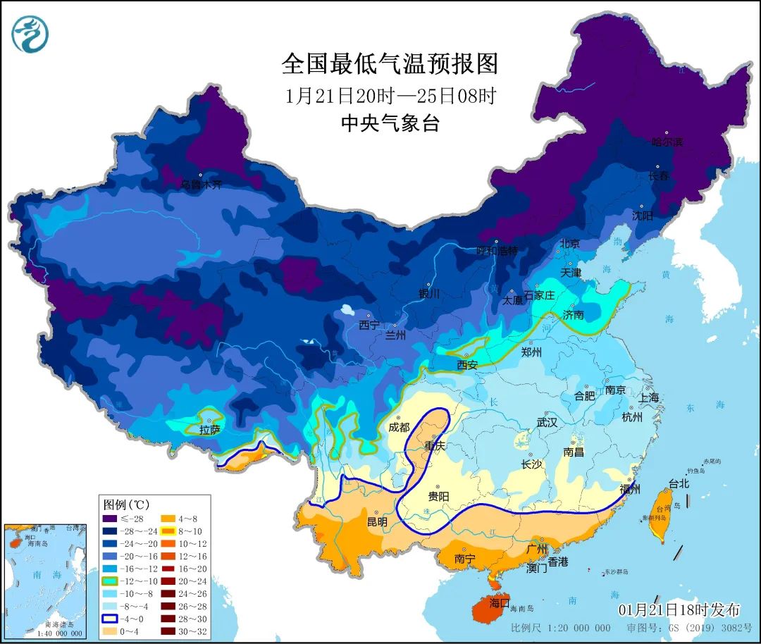
It is estimated that the temperature in the central and eastern regions will be 4 ~ 6℃ lower than normal, and that in the eastern part of North China and the eastern part of Northeast China will be 8 ~ 10℃ lower. The lowest temperature in most parts of central and northern Heilongjiang will reach-35 ~-40℃, which may be close to or below the historical extreme value in the same period.
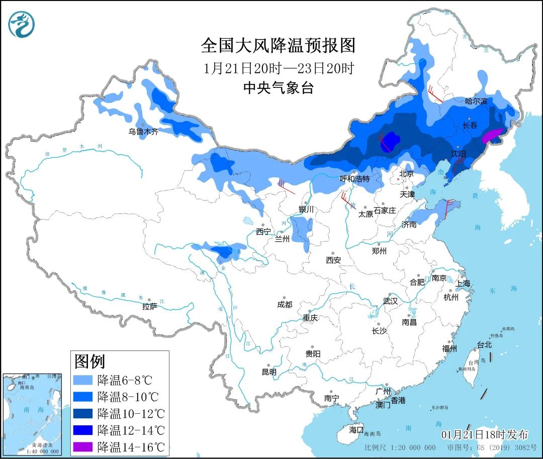
Among them, from 20: 00 on January 21 to 20: 00 on January 23, the temperature in most parts of Inner Mongolia, the south-central part of Northeast China, northern Xinjiang, Hexi in Gansu, southern Ningxia, northwestern Shanxi and northern Hebei will drop by 6 ~ 8℃ successively, and the temperature in most parts of central and eastern Inner Mongolia, eastern Jilin and Liaoning can reach 10 ~ 14℃. Some of the above areas are accompanied by 4-6 winds and gusts of 7-8. There are 6 ~ 8 winds in the northern and eastern seas, and the gust is about 9.
Rain and snow forecast:It is estimated that there will be small to medium snow or sleet in parts of eastern northwest, central Inner Mongolia, northern North China, northeast China, eastern Huanghuai and eastern Southwest China from 22nd to 24th, and freezing rain in western Guizhou. There is light rain in the south.
In addition, from 24th to 28th, there were persistent snowstorms in southwest Tibet, with heavy snowstorms and local blizzards from Pulan to Nyalam, which were extremely extreme.
Meteorologists reminded that the cold air process has a wide range of influence and significant cooling, which will aggravate the low temperature in the central and eastern regions. At present, it is the Spring Festival holiday, so please take measures to keep out the cold in advance, especially for passengers on their way home. Please pay attention to the latest forecast information and pay attention to traffic safety! The snowstorm in western Tibet lasts for a long time, so please take precautions!
关于作者